City Planning, Accelerated.
Spend less time on routine tasks and more time on the meaningful work only planners can do. Waypoint is the best way to use AI for city planning.

Trusted By.


The Waypoint Assistant
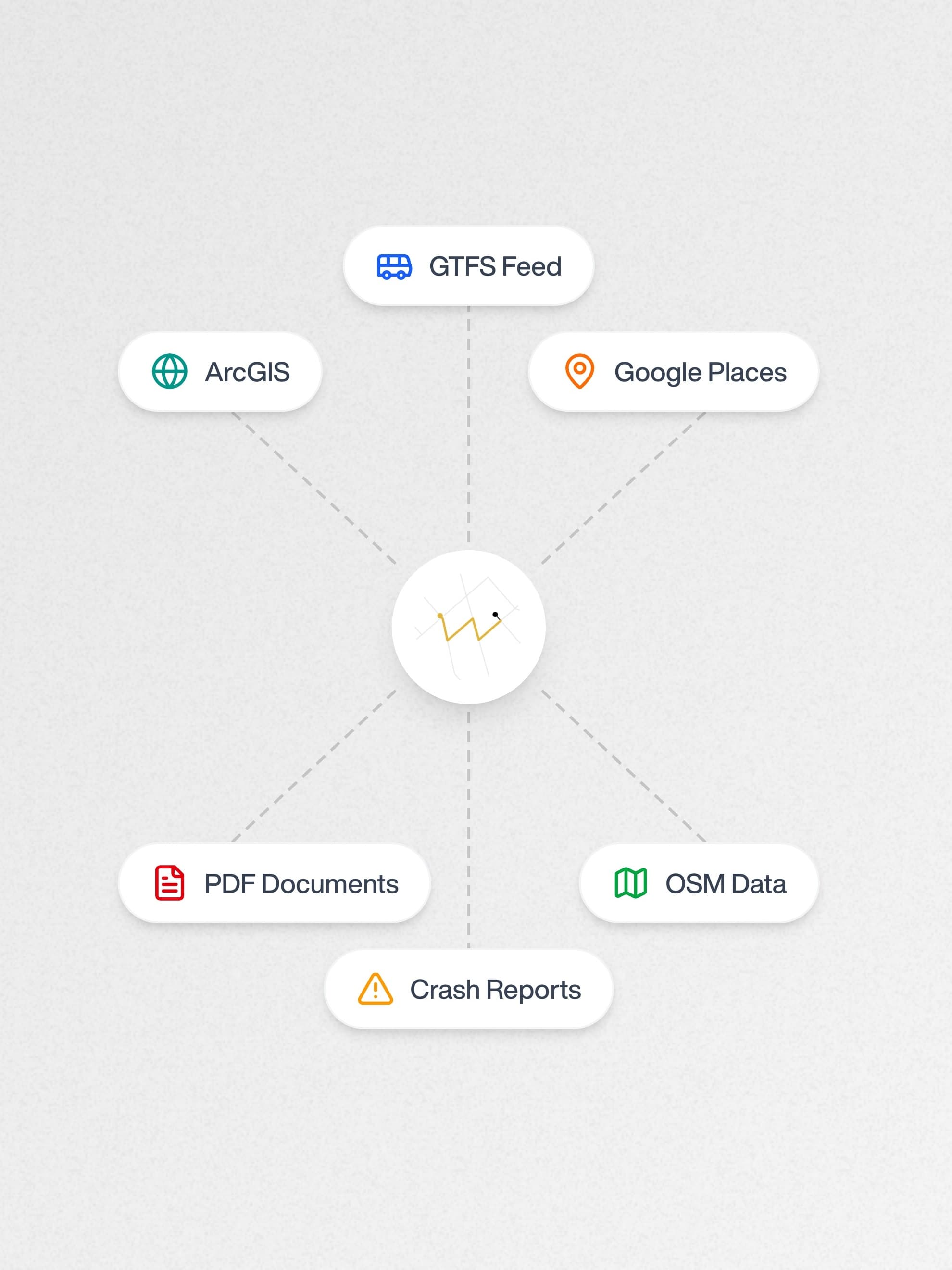
A unified tool that connects to the data sources planners depend on—completing tedious tasks in minutes, not hours.
Run spatial joins, buffer analyses, and complex GIS operations using plain language—no need to remember which button does what.
Comprehensive corridor analysis with data-driven insights for transportation planning and safety improvements.
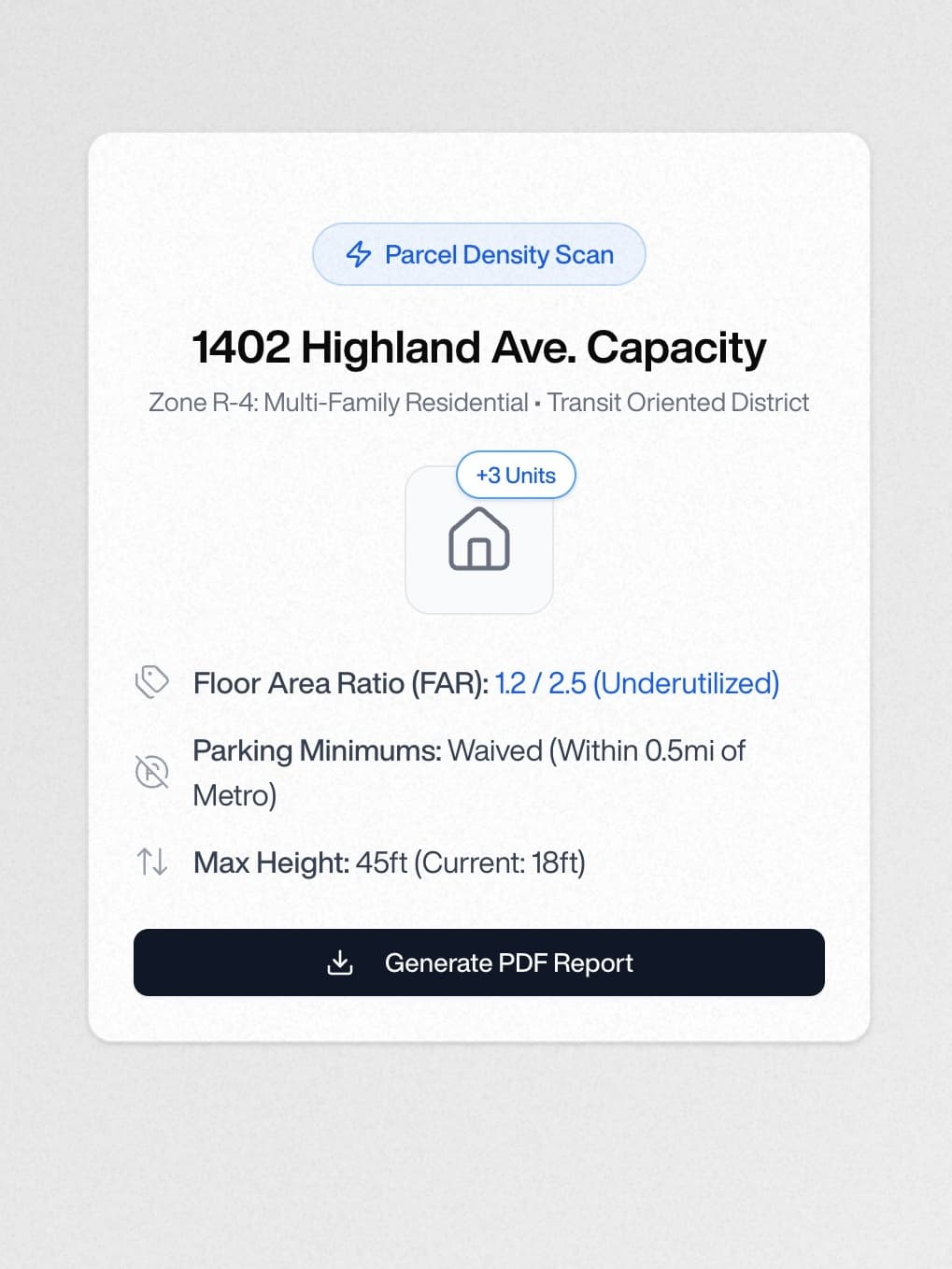
Streamline your development review process with AI-powered analysis and automated report generation.
Automated safety assessments that identify risks and recommend evidence-based countermeasures.
Support for complete streets and Vision Zero initiatives with multimodal transportation analysis.
Analyze economic impacts of transportation investments and identify opportunities for growth and revitalization.
Built For You
Every municipality and planning firm is unique. We work closely with you to build automations and custom workflows that meet your specific needs.
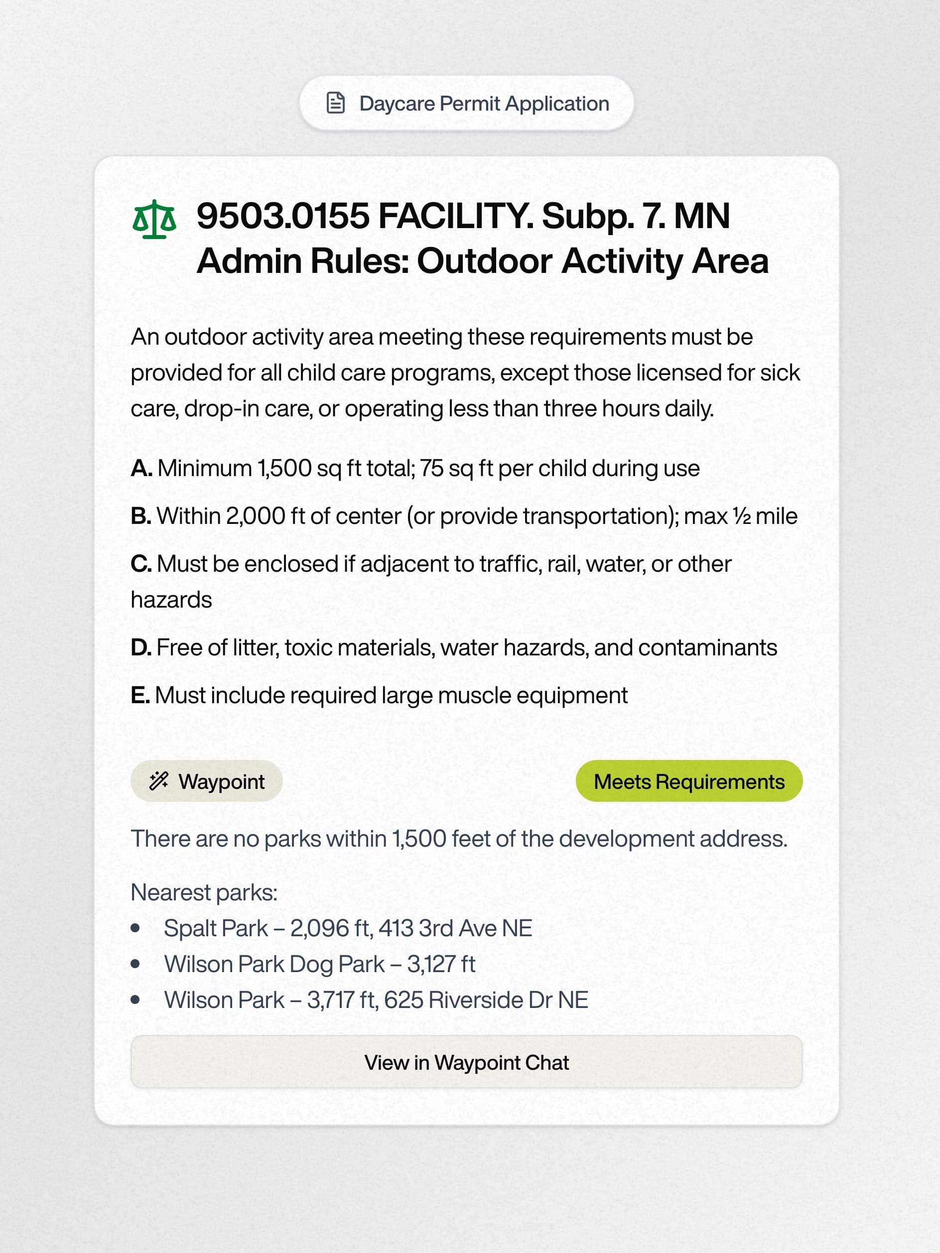
Permitting Review
Automate permit review against your city's municipal codes and generate memos that match your exact format.
Data Integration
Connect all your data sources—crash reports, GIS layers, transit feeds, and more—into one unified platform.
One Off Analyses
Need a quick analysis or custom report? We can help you get the answers you need, fast.
Our Work.
Let's Work Together.
We'd love to work with you. Send us a message, and we'll schedule a time to learn about your needs.
Contact UsBacked by Kyber Knight, YCombinator, and other great investors.